
Enter all the desired criteria: the apps that satisfy them all will be searched; if a criterion is specified multiple times, only the last occurrence will be considered.
 Once you’ve entered the app you have the possibility of choosing between two types of geographical maps. The first is a standard map, while the second is a regional map (or a city map).
 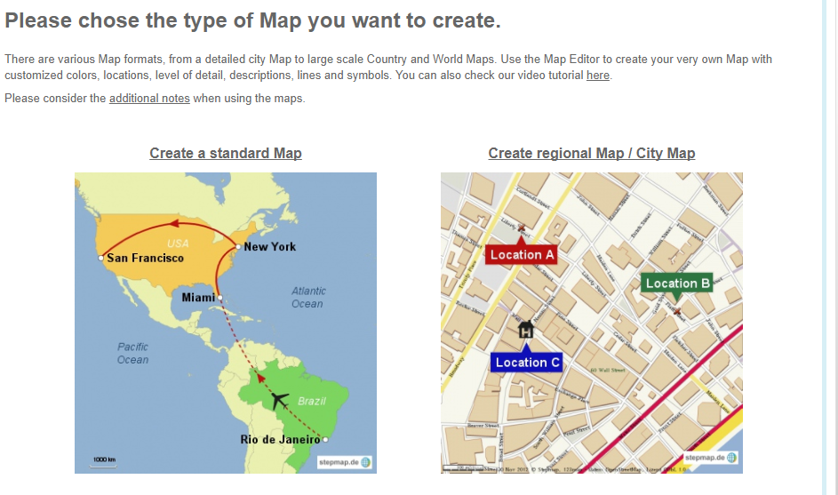 To create a map you must follow 4 steps; first you must choose your zone of interest, the scale of the map and the elements of interest that you wish to include (cities, borders, lakes, mountains, roads, pedestrian zones, parks…). Next you can create connection lines between two points on the map or insert symbols. Then you can insert a photo or a video for each position that you create on the map and even add a little description. Lastly you can complete you work by inserting a description for the project and some keywords that will be seen in the “uploaded multimedia files”.
 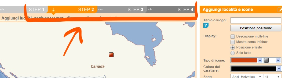 Once you’ve completed your map you can choose the “save map” option and a page will appear where you can download it, add it to a website or in your blog, share it on Facebook, Twitter or on Google+, modify or delete it. The final product will be saved on the app’s cloud that you can access via “my maps”.
 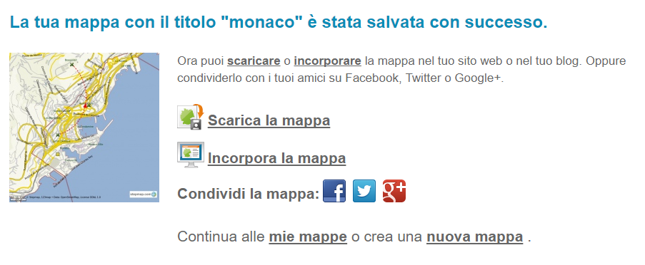 This app is versatile because of its many personalisations and it can be easy to use for school to create complicated information based on a geographical map, it can be useful in history, geography...


Copy link