
Enter all the desired criteria: the apps that satisfy them all will be searched; if a criterion is specified multiple times, only the last occurrence will be considered.
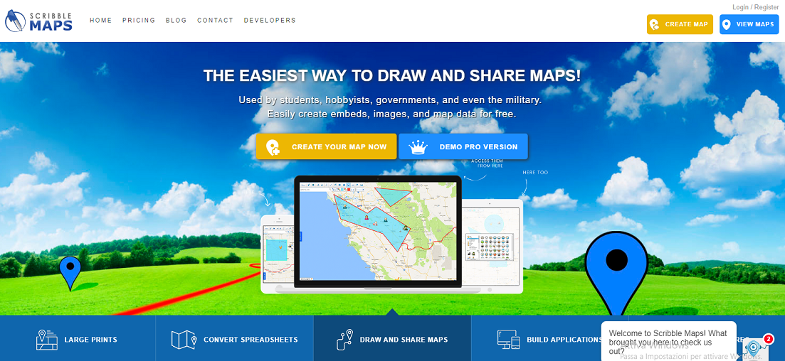 Once clicked, the following page will open. The product that can be created is a 2D geographic map. It is possible to choose to view the map in different modes, from the satellite vision to the nautical chart, from the political map to the road map, by clicking on the button at the bottom right. Subsequently we will be able to draw on the map, add icons or highlight areas through dedicated tools available in the bar at the top left. For each tool that we will choose to use it will be possible to define the color, the transparency, the thickness. In the tool table, still, a search bar is present, in which you will be able to type the location that we want to visualise in our map and by clicking on the submit button we will immediately viewing it.
 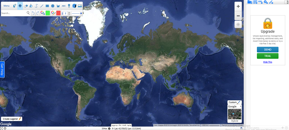 Once the map is created, it will be possible to save it by clicking on the “menu” item of the toolbar. The following box will open, which we will be able to save the map into, as well as export or share it.
 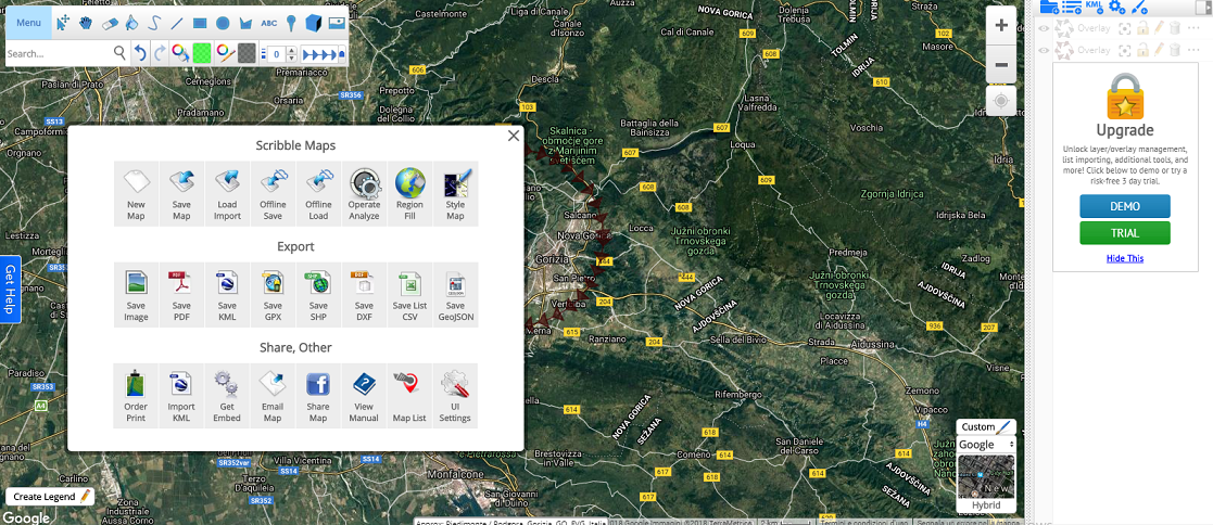 Concerning the paid version, it will be possible to use it for three days of trial; after that you will have to choose one of the following paid packs.
 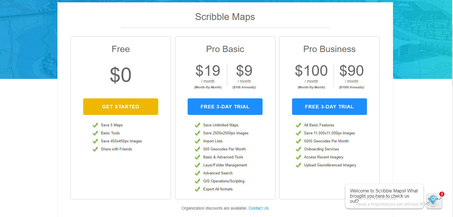 The paid version allows you to view an interface that is more advanced than the free profile’s one, use different maps such as the isometric one, the density one, the bar and cafés one etcetera, but also use basic and advanced tools as well as save an unlimited number of maps. Below is the main page of the paid version of Scribblemaps.
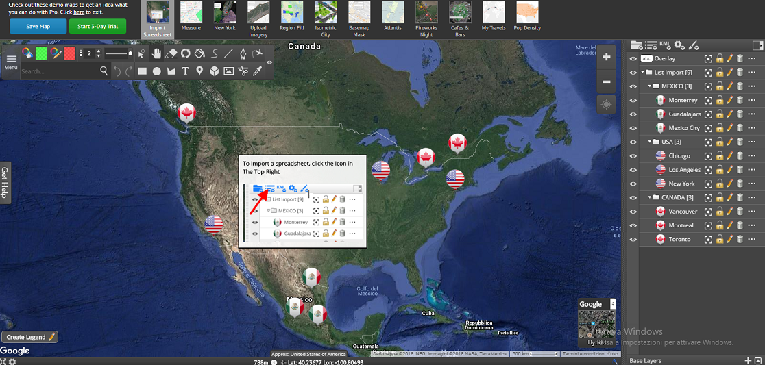


Copy link